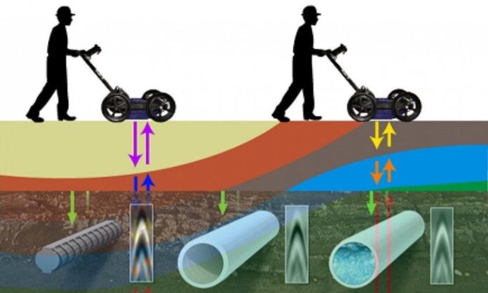
Seismic inversion software is a powerful technique used in geophysics and exploration, has undergone significant advancements in recent years. This innovative process enhances the accuracy and resolution of subsurface imaging, revolutionizing the way we understand the Earth’s subsurface structures. Through the integration of advanced algorithms, improved data acquisition methods, and enhanced computing capabilities, seismic inversion has generated even better results, providing valuable insights for industries such as oil and gas exploration, geothermal energy, and geological studies. In this article, we will explore the advancements in kingdom seismic inversion and how they have revolutionized subsurface imaging.
Improved Data Acquisition Techniques
Advancements in seismic acquisition techniques have played a crucial role in enhancing the quality and quantity of data used in seismic inversion. Modern acquisition technologies, such as multi-component sensors and broadband recording systems, capture a broader spectrum of seismic waves. This allows for more accurate characterization of subsurface properties, including lithology, fluid content, and structural complexity. By obtaining high-resolution data, seismic inversion algorithms can leverage a more comprehensive dataset, resulting in more precise and detailed subsurface models.
Advanced Inversion Algorithms
The development of sophisticated inversion algorithms has been a game-changer in seismic imaging. These algorithms utilize mathematical and computational techniques to invert seismic data and estimate subsurface properties. Traditional methods focused on simple layer-based models, but recent advancements have enabled more complex inversion approaches, such as full waveform inversion (FWI) and simultaneous inversion. FWI has gained prominence by considering the full seismic waveform and providing highly detailed velocity models. These advanced algorithms offer improved accuracy, resolving subsurface features that were previously challenging to detect.
Integration of Multi-Physics Data
Incorporating additional geophysical data, such as electromagnetic surveys, gravity data, or well logs, has become increasingly common in seismic inversion workflows. The integration of multi-physics data helps constrain the inversion process, enhancing the reliability and accuracy of the subsurface models. By combining different data sources, geoscientists can cross-validate information and reduce uncertainties. This multi-disciplinary approach leads to more robust interpretations and a better understanding of subsurface structures, enabling more informed decision-making in various industries.
High-Performance Computing
The advancements in high-performance computing have significantly accelerated seismic inversion workflows. Complex inversion algorithms require substantial computational power to process large volumes of data efficiently. The availability of parallel computing architectures, cloud-based computing resources, and advanced algorithms optimized for distributed computing have revolutionized the speed and efficiency of seismic inversion. These advancements enable geoscientists to process vast datasets in a fraction of the time, improving productivity and facilitating faster decision-making processes.
3D Visualization and Interpretation
The integration of advanced visualization techniques and 3D interpretation tools has transformed the way geoscientists analyse and interpret seismic inversion results. Interactive 3D visualization platforms allow for a more immersive exploration of subsurface models, facilitating better understanding and interpretation of complex geological structures. Geoscientists can now interactively analyse seismic attributes, perform volumetric calculations, and visualize uncertainties, enabling more accurate reservoir characterization and aiding in resource estimation and risk assessment.
Applications in Various Industries
The advancements in seismic inversion have broad applications across industries. In the oil and gas sector, improved subsurface imaging facilitates better reservoir characterization, optimizing drilling locations, and maximizing production. Seismic inversion has also found relevance in geothermal energy exploration, providing insights into geothermal reservoirs, and helping identify suitable sites for efficient energy extraction. Furthermore, seismic inversion is crucial in geological studies, enabling scientists to unravel the Earth’s history, understand fault systems, and map subsurface structures for infrastructure planning and natural hazard assessments.
Advancements in seismic inversion techniques have revolutionized subsurface imaging, offering geoscientists and industries unprecedented accuracy and resolution in understanding the Earth’s subsurface structures. The integration of improved data acquisition techniques, advanced inversion algorithms, multi-physics data, high-performance computing, and advanced visualization tools has generated even better results. These advancements have far-reaching implications, enhancing resource exploration, optimizing energy extraction, improving geological studies, and aiding in infrastructure planning. As seismic inversion continues to evolve, we can anticipate further advancements that will unravel the mysteries of the Earth’s subsurface and drive innovation in various industries.


